Spring Battlefields 2019 Day Three: Passchendaele

Today was another sunny one so I made the most of it by going for a long walk. On my way I stopped in at Ypres to replace my lost copy of Walking Ypres, and even managed to get a signed one! Ypres Grote Markt was closed to traffic this morning and was instead filled with amateur cyclists riding the Gent-Wevelgem sportive, so it had a great atmosphere.
I drove on out of Ypres and parked next to the church in Sint Juliaan to begin my walking, heading in the general direction of Passchendaele. I didn't really have a solid plan for the day: the page in my itinerary was just two printed maps of the area, but I decided to take full advantage of my Linesman trench maps and follow in the general direction of the British advance at the Third Battle of Ypres.

This map shows roughly where I went (following the black loop). In the end, my walk ended up being about 14 miles - and that was with a couple of shortcuts taken to cut out Poelcapelle and Passchendaele village, which I had originally intended to visit. It was a tiring day, especially in the sun, but was also really interesting to get to know the landscape of such an important battle.

At the start of my walk I visited a couple of cemeteries which are in and near St Juliaan. The first was St Julien Dressing Station cemetery, which was used to bury those who died of their wounds from September 1917, in line with the general advance.

Bridge House Cemetery, just down the lane, was begun at a similar time and most of the burials here date from a few days in September, when the Battle of Polygon Wood (a phase of 3rd Ypres) was being fought nearby. Among them are five members of the Royal Army Medical Corps buried side by side, who all died on 25th September 1917. I'm not sure of the story behind their deaths, but I presume it was something like a shell falling near to where they were working.
From here I turned back in the direction of St Juliaan but cut up east on what the trench maps had marked as a track, but what was now the edge of a field. I walked up to what had been the German front line up until 20th September at a spot which the Canadian troops had nicknamed 'Winnipeg'. I was a bit concerned that there wouldn't be a way out of the fields, but after only one cross-country-style ditch jump I made it onto the Langemark road. This area felt remarkably flat, with little to indicate Passchendaele Ridge off to the right.

I crossed almost straight over the road and took a lane further east. Here the road began to rise just a couple of per cent gradient onto what the old maps marked as London Ridge. I think it was here that I got my first view of Passchendaele church spire on the horizon, although I may have confused this with another village. The landscape here is wide open and the hill up the ridge very gradual, far moreso than yesterday's route up to Wytschaete.

Following the German 'Dimple Trench' north I walked up to a windmill that stood at the centre of a road junction. This is a rebuild of the original mill, which the Germans had used as an observation point during their occupation of this area, christening it the 'totenmuhle' or Death Mill.
I turned right here with the intention of walking on to Poelcapelle but I was already starting to feel hungry (it was nearing lunchtime) so I instead decided to walk in the direction of Tyne Cot. I'm very glad I did! Coming through this section, there was very little of anything to note, and nothing could be seen on the horizon. Along here, past Quebec Farm (another Canadian tribute) I crossed the British frontline of 20th September 1917, on the ground captured by the XVIII (18th) Corps on that date.
Walking along this lane, I noticed how in this route there was a notable lack of cemeteries and memorials. For such a hard fought area, there are comparatively fewer lasting marks of the war than there are in other parts of the Western Front, particularly if you compared it to the Somme. Largely this is due to the concentration of graves into Tyne Cot Cemetery, which replaced the many battlefield cemeteries that are strewn across the landscape in other places.
This lane soon felt like it was going on forever, past farms which had been nicknamed after Winchester and Wellington, as well as Kronprinz and an interesting feature known as 'Peter Pan', the reason behind the name I couldn't find. Just past Kronprinz I crossed the front line of 4th October and on to the area which had been the territory of the 18th Division at the Battle of Poelcappelle phase of 9th October.
Eventually I came to another road and crossed over onto the lane which would bring me into the bottom side of Tyne Cot Cemetery. This area must have had considerable drainage problems during the war, with features named 'Marsh Bottoms' and 'Waterfields' on the trench map.


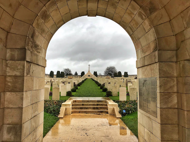
I stopped for lunch at Tyne Cot and then had a short wander through the cemetery in the sunshine. This is somewhere I have visited a number of times before, but I decided to stop in anyway rather than going straight past. Plus, the sun was out so it was a prime opportunity to take some good photos. It wasn't very busy in the time that I was there. One coach group left just as I was arriving, and then there were only a few other small tours and family groups who came and went.

After Tyne Cot I decided to head back towards St Juliaan and turned south west along a lane marked as 'Abraham Heights' on the old maps. This was a target for the New Zealand forces in October 1917. They attacked into unbroken German machine gun positions, yet managed to secure their objectives and take both Abraham Heights and the next road up, which I had just walked along, parallel with Tyne Cot.

At the end of this road is the New Zealand Memorial, marking this victory. I turned left here and headed south west again. The gradient of the road was really apparent here and must have been one of the steepest points I walked all day, yet still not as steep as Wytschaete. While a steep approach certainly complicated an attack, the land here is so wide open that the shallow ridges offered absolutely no protection from the defenders on higher ground.

Continuing down here, I passed a concrete bunker still in position, now in the side of a drainage ditch and walked on down through an area known to the soldiers as Wimbledon. At the next crossroads I turned left down to Dochy Farm Cemetery, one of the few in this area.

This had been a German strong point until it was taken on 26th September 1917 by 2/5th Lincolnshires. The 1,500 burials here were all brought in from isolated spots after the war, yet were those deemed too far away to be moved up to Tyne Cot. The cemetery is now on a junction between the main road and a small lane, which I turned down back in the direction of St Juliaan.

The place names down here were confusingly taken from earlier battles in the war, with features labelled 'Gallipoli' and 'Somme'. I walked back past the land taken in September 1917 and past a memorial to Irish soldiers who had fought here in 1917. This was a recent memorial, unveiled at the centenary, and consists of a large stone and a signpost, bearing the distances to places both in Ireland and in connection with the divisions. It is astride the border between the positions of the 16th (Irish) Division and 36th (Ulster) Divisions, the latter of which had previously won acclaim on the Somme.
The last lane brought me back level with the front of 31st July and then back into the village of St Juliaan. While this walk wasn't the most noteworthy in terms of memorial sites and cemeteries, it was very interesting to get to know this area better, and to understand the ground leading up to Passchendaele. It was also a walk that wouldn't have been anywhere near as interesting if I didn't have the trench maps to hand, so I'm definitely pleased that I decided to buy Linesman Great War Digital.
By the time I got back to the car around 4pm, I was feeling worn out both from the walk and the weather, so I decided to call it a day and drove back to Talbot House. Tomorrow, I'm going to watch the Gent-Wevelgem race so I'm not sure what my battlefields plan will be aside from that but I'm sure I'll come across some interesting things.
Kathryn


No comments: